Search Results
110 items found for ""
- Multi-GNSS: Advantages, Challenges, Test Solutions
Multi-GNSS: Advantages, Challenges, Test Solutions DOWNLOAD PDF By Tyler Hohman DOWNLOAD PDF
- PSPT | Safran Federal Systems
Home • Products • Custom Solutions • PSPT PSPT Portable Survivable Precision Time Clock PSPT PRODUCT | RESILIENT PNT Multi-GNSS Synchronization GPS, GLONASS, Galileo, Beidou, QZSS Modularity Built-in functions extendable with up to 2 optional input/output module Networking 2 1-Gigabit Ethernet ports, NTP and PTP ANY QUESTIONS? GET QUOTE About Founded on Safran’s SecureSync® precision time and frequency technology. The PSPT provides a portable precision master clock capabilities that can be easily transported. Use cases include locations that require a temporary GNSS based time and frequency synchronization due to a system failure or lighting strike. Portable Jamming and Spoofing detection capabilities (optional). In addition, the PSPT can also be utilized as a test tool to validate remote site timing and frequency synchronization against UTC traceable time. Features – Multi-GNSS synchronization (GPS, Galileo, GLONASS, BeiDou, QZSS) – GPS jamming and spoofing detection option – Internal prevision timekeeping via Rubidium Oscillator – Supports a wide variety of available input/output signals Modularity Built-in time and frequency functions are extended with up to 2 optional input/output modules. The PSPT unit provides configurable Input/Output timing interfaces (TTL pulse, RS232/RS485, IRIG AM/DCLS), in addition to 10 MHz and 1 pps outputs. If more interfaces are needed, the base unit supports 2 option cards, enabling multiple combinations of frequency, phase, NMEA or Have Quick time codes, or network synchronization. Networking The PSPT provides strong and scalable networking capability, thanks to higher embedded processing power. Two, 1 Gigabit Ethernet ports (one RJ45, one SFP) are available on the base unit enabling flexible network synchronization as a NTP server or PTP master/slave as a NTP stratum 2 server, or as a PTP slave/boundary clock. Click to download the PSPT data sheets. VIEW DATA SHEET
- GPS Receiver Testing: From the Lab to the Field
GPS Receiver Testing: From the Lab to the Field DOWNLOAD PDF By Tyler Hohman DOWNLOAD PDF
- Equipment Pointing & Radar Directional Capabilities For Defense Applications
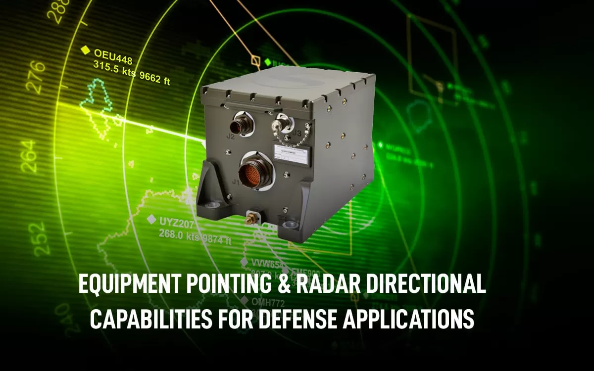
Equipment Pointing & Radar Directional Capabilities For Defense Applications DOWNLOAD PDF By Anthony Full Problem We Solve In order to properly orient a vehicle-mounted weapon, or any radar system that relies on global navigation satellite signals, vehicle crews need accurate heading data to point their equipment. Operators may start with estimating trajectory paths, but it is hard to know exactly where their equipment is pointing because any slight change in angle causes a massive change in impact location or radar direction. Operating in a GNSS-denied environment also presents challenges, and it would be time consuming and potentially dangerous to wait for clean signal reception. Inertial Navigation Systems (INS) that provide true north-finding capabilities is an extremely helpful and flexible alternative because it allows vehicles to have high accuracy orientation capabilities for their mounted weapons or radar payloads. They can minutely adjust their angles or rotation without the aid of GPS, and without being susceptible to vibrations and shocks. Why Is It Important Having precise orientation capabilities is critical in ensuring weapons effectively designate their targets. Likewise, having accurate orientation in radar systems is essential in the process of geographically locating objects. The act of orienting a vehicle weapon or radar is not trivial: accurate shooting requires complex calculations from numerous factors including determining level ground, finding the north pole, measuring wind speed and direction, and elevation of the target. Highly accurate equipment pointing can mean the difference between mission failure and success. Therefore, having a robust navigation system that can provide heading data in real time is of paramount importance for defense applications. Given that the National Intelligence Council has identified an increasing trend in jamming and spoofing attacks, the need for navigation systems to be able to operate independent of GPS signals is also becoming important. Inertial navigation systems need to be able to operate in both normal conditions as well as GPS-denied environments. Of course, there are different grades of accuracy for equipment pointing depending on your needs. And we’ll cover the most relevant solutions next. How We Solve it When it comes to navigation systems that can provide heading data in real time Safran has field-proven solutions for diverse defense applications. The Geonyx product incorporates HRG technology, unlike GPS, INS does not rely on external signals for navigation and heading. Instead, it uses motion sensors and rotation sensors to calculate the position, orientation and velocity of the vehicle based on internal data. The Geonyx will output pitch, roll, and heading data to the vehicles weapon system or to the vehicles radar system via ethernet. GEONYX INERTIAL NAVIGATION SYSTEM Geonyx is an INS solution for ground vehicles and artillery pointing systems, offering a virtually unlimited and maintenance-free lifespan. It can achieve a pointing accuracy of <0.5 mils thanks to HRG Crystal technology. It has quick and flexible alignment – even in GNSS-denied environments. DOWNLOAD PDF
- Custom Solutions | Orolia Defense & Security
Home • Products • Custom Solutions Custom Solutions We work with you to accommodate your mission requirements. Our open architecture approach allows for so many possibilities, no idea is out of the question. Browse Products PRODUCT | Personnel Recovery Device World's First Cospas-Sasat Certified Second-Generation Beacon Our Personnel Recovery Device is the world’s first personal locator beacon built specifically for the US Army that utilizes the Second Generation Cospas-Sarsat signaling technology for the most demanding search and rescue environments. It’s an innovative robust, ruggedized, dual-mode, user-friendly beacon. PERSONNEL RECOVERY DEVICE PRODUCT | Widebody VersaSync Flexible Time and Frequency Reference Built on the Versa platform, the Widebody VersaSync has an expanded chassis that is ideal for land, sea and airborne applications. Its design can be outfitted to match your needs, no matter the mission. Built to endure the most demanding conditions, the Widebody VersaSync delivers reliable, uninterrupted signals. WIDEBODY VERSASYNC PRODUCT | CPNT CMOSS PNT Card CPNT fuses GNSS, inertial measurement, and high-performance timing oscillators with GNSS jamming and spoofing detection and CRPA/AJAS antenna compatibility in a flexible, configurable device to provide PNT assurance in threat-filled environments. Compliant with the C5ISR/EW Modular Open Suite of Standards. CPNT PRODUCT | PSPT Portable Survivable Precision Time Clock Founded on Safran’s SecureSync® precision time and frequency technology. The PSPT provides a portable precision master clock capabilities that can be easily transported. PSPT Integration Options Our layered, modular platform allows you to pick and choose which elements to integrate into your system. Our experts will help you decide what is needed based on your requirements. Work with our team to customize a solution by reaching out today.
- Orolia Unveils M-Code Enabled Mobile Timing & Sync Solutions
Orolia Unveils M-Code Enabled Mobile Timing & Sync Solutions ROCHESTER, NY, November 12, 2020 DISTRIBUTION A: Approved for public release; distribution unlimited Orolia, the world leader in Resilient Positioning, Navigation and Timing (PNT), through its Orolia Defense & Security business, has announced the availability of M-Code Military GPS receivers in its Resilient PNT products and solutions, including M-Code enabled mobile mission timing and synchronization platforms. M-Code capabilities further enhance Orolia’s Versa mobile PNT platform for rugged, small SWaP-C requirements and Orolia’s flagship SecureSync® resilient time and frequency reference solution- the first Defense Information Systems Agency (DISA) approved time server. M-Code is a military signal used in the L1 and L2 GPS bands and required by Congressional mandate for Department of Defense (DoD) military operations. Designed to enhanced positioning, navigation, and timing capabilities and improved resistance to existing and emerging GPS threats, such as jamming and spoofing. M-Code offers several operational benefits including a higher-power signal that offers improved resistance to jamming and interference; advanced security features to prevent unauthorized access or exploitation; and improved message formats and signal modulation techniques for faster and more accurate performance. “As threats against GPS increase, military forces will need M-Code capabilities on mobile PNT systems to ensure continuous operations wherever they go,” said Hironori Sasaki, President of Orolia Defense & Security. “Orolia is proud to continue to support Department of Defense initiatives to ensure that warfighters have the most secure, reliable and accurate positioning, timing and synchronization solutions in any environment.” From resilient PNT solutions to GPS/GNSS simulation, interference detection, and mitigation, Orolia is the industry leader in end-to-end NAVWAR and Resilient PNT solutions to protect, augment and strengthen military systems for GPS-denied environments. About Orolia Defense & Security Orolia Defense & Security provides Resilient PNT solutions and custom engineering services to U.S. Government agencies, defense organizations, and their contractors. Orolia Defense & Security is authorized to work on the full spectrum of U.S. Government classified and unclassified projects, in addition to supporting strategic partnerships for key defense PNT technologies. www.OroliaDS.com Orolia Defense & Security operates as a proxy-regulated company and wholly owned subsidiary of Orolia, the world leader in Resilient PNT solutions for military and commercial applications worldwide. www.Orolia.com Contact: Rachael Smith 614-736-3736 rachael.smith@oroliaDS.com VIEW PDF
- Electronic Warfare | Safran Federal Systems
Home • Applications • Electronic Warfare Electronic Warfare There are many forms of electronic warfare in today's modern battlefield. One of the more common arenas is within the Position, Navigation, and Timing (PNT) realm - or what our industry refers to as NAVWAR (Navigation Warfare). With expertise that goes back 30+ years, this is where Safran Federal Systems thrives. NAVWAR and EW • Testing Capabilities • Field Solutions • Offensive Capabilities How does NAVWAR differ from other forms of Electronic Warfare (EW)? NAVWAR is a subset of Electronic Warfare that targets GPS and other PNT signals or sensors in which the warfighter depends upon. Typically, people think of GPS in the way that most people use it today – on a screen on their phone or in their car, getting you from point A to point B. But what people don’t realize is how just how many mission-critical systems rely on GPS to function, and how vulnerable it is to attack. For example, a warfighter's precise location is needed for rescue. If their systems are attacked electronically and they lose their GPS position, it can have devastating consequences. NAVWAR and EW Addressing today's challenges in Electronic Warfare From the lab to the field, Safran’s Electronic Warfare solutions back the warfighter at many crucial stages: Test, Detect, and Defeat. Safran’s proven expertise in GPS jamming & spoofing simulation and protection has enabled them with the ultimate toolkit for EW capability. Your mission can start taking advantage today by inquiring about our capabilities. INQUIRE TODAY Why is NAVWAR testing important? Protecting your systems in the field starts in the lab. How do you give warfighters the confidence that their systems will continue to perform in a theatre abundant with NAVWAR attacks? This is where Testing & Simulation are extremely important. You want to know before you go to the field, how your systems are going to react to all types of threats. Testing Capabilities Testing with BroadSim Safran offers a range of simulator solutions that support applications from underwater to outer space. This is all achieved through BroadSim, our flagship line of software-defined simulators. Our team of experts will work closely with you to understand your needs Choose or customize the solution that gives you the tools required to achieve mission success Powerful GPU-driven platform Easily scaled to support signal capacity and high dynamics Skydel software/interface is shared across all BroadSim simulators Going from the lab to the field Situational awareness in the field is another important aspect of protecting your systems that Safran address through two of its solutions, BroadShield and BroadSense. Both give situational awareness to the warfighter by detecting GPS Jamming and Spoofing signals in the environment in real-time, based on the same patented algorithms which have been proven to be successful in the field for close to 15 years, and are continuously updated and improved to address the latest emerging threats. An embedded software solution Easy integration into a user’s system Detects malfunctions/anormalities Quickly verifies if it's NAVWAR attack Can be programmed to send alerts or switch to a backup source so there’s no interruptions in service. BroadShield LEARN MORE BroadSense Nano A handheld sensor device Low-cost, size, weight, and power Used for on-the-go situational awareness Is easily carried or mounted Screen displaying critical information Jamming, spoofing, and J/S Integrated or external antenna options LEARN MORE Field Solutions Going on the offense Safran's proven expertise and experience in testing and simulation, along with defensive measures like detection, has allowed them to be extremely proficient in channeling that technology for fielded systems. Inquire today about Safran's capabilities to learn about the success they’ve already been able to demonstrate and how it’s being used to aid the warfighter. INQUIRE TODAY Offensive EW Capabilities
- SpaceNaute | Safran Federal Systems
Home • Products • Inertial Navigation Systems • SpaceNaute ™ SpaceNaute™ Ultra-compact navigation system for space launchers SpaceNaute ™ PRODUCT | INERTIAL NAVIGATION SYSTEMS Gyro bias < 0.01°/h Accelero bias < 50 μg SWaP 3 L / 11 lbs / 15 W ANY QUESTIONS? GET QUOTE About Competitive, accurate and compact, SpaceNaute is the most advanced inertial navigation unit for space applications in the world. Selected for Ariane 6, it offers excellent performance and very high reliability under harsh conditions. SpaceNaute inertial guidance system provides high performance inertial guidance thanks to: HRG Crystal™ cutting-edge technology for foolproof reliability Insensitive to space radiation and vibration Compact and low weight Reliable Rugged Low SWaP HRG Crystal™ cutting-edge technology for foolproof reliability Insensitive to space radiation and vibration Compact and low weight A game-changing new generation SpaceNaute offers the best of its generation, all criteria combined: SWaP, robustness, longevity, precision… Guaranteeing space launchers perfect control over their navigation and orientation in space, SpaceNaute inertial guidance system covers all space applications, from put into orbit to space exploration. Click to download the SpaceNaute ™ data sheet. VIEW DATA SHEET
- BroadSim Solo | Safran Federal Systems
Home • Products • GNSS Testing & Simulation • BroadSim Solo BroadSim Solo Single-Output Software-Defined GNSS Simulator BroadSim Solo PRODUCT | GNSS TESTING & SIMULATION Simulation Capability All constellations and frequency bands, jamming or spoofing, one at a time, on one RF output Encrypted Military Codes AES M-Code Shared Benefits Intuitive user interface, high-dynamics, comprehensive API and ultra-low latency ANY QUESTIONS? GET QUOTE About Designed to address the permanent challenges that engineers face with laboratory capacity and availability, BroadSim Solo was developed to bring advanced GNSS scenario creation to your desk and propel development cycles. Total Freedom Instead of scheduling time around and limiting use to 1-2 simulators in a lab, an entire team of engineers can have BroadSim Solos at their desks, working on different simulation projects & tasks, while letting the lab simulators run the primary scenarios. BroadSim Solo allows you to create a simulation eco-system that is scalable based on the size of your team, and non-location-dependent, which accounts for the rising popularity of flexible work positions. Empower your entire team by adding BroadSim Solo to your simulation ecosystem. Compact form factor fits nicely at your desk or workstation Remarkably affordable price point Increase performance and drive innovation RESOURCES New Product Press Release Button Learn how to quickly create and automate a multitude of dynamic spoofing scenarios using BroadSim. Terrain Modeling Demonstration Button Learn how terrain modeling is a cost-effective alternative to field testing, demonstrated using BroadSim Solo Click to download the BroadSim Solo data sheet. VIEW DATA SHEET
- BroadSim Onboarding | Safran Federal Systems
Home • Support • BroadSim Onboarding Getting Started with BroadSim Learn how to use the Skydel Simulation Engine with our BroadSim line of products, from the moment you receive your package to setting up your first scenario. Onboarding and Tutorials Our onboarding series will help you learn more about your BroadSim device. BroadSim Onboarding: Getting Started Play Video Play Video 04:20 BroadSim Unboxing Tutorial Orolia Defense & Security Applications Engineer, Alaiya Tuntemeke-Winter, takes you through the process of unboxing your BroadSim. Learn more about BroadSim: 🔗https://www.oroliads.com/broadsim User Manual: 🔗https://owncloud.talen-x.com Play Video Play Video 06:22 BroadSim Setup Tutorial Follow along with Orolia Defense & Security applications engineer, Alaiya Tuntemeke-Winter, as she takes you through the process of setting up your new BroadSim. Learn more about BroadSim: 🔗https://www.oroliads.com/broadsim User Manual: 🔗https://owncloud.talen-x.com Play Video Play Video 07:36 BroadSim Operating System Overview Follow along with Orolia Defense & Security applications engineer, Joshua Prentice, as he takes you through our third onboarding video, which now covers our custom BroadSim operating system. Learn more about BroadSim: 🔗https://www.oroliads.com/broadsim User Manual: 🔗https://owncloud.talen-x.com Play Video Play Video 02:12 Skydel Automation This video gives an overview on Skydel's innovative automation panel. The Automation panel makes automating GNSS simulation an easy task by automatically recording everything that happens in the Skydel UI, and any commands issued through the API. These commands can then be edited, saved, and played back as a sequence, much like a macro.These commands can also be exported as a python script which you can modified instead of starting with a blank page for your automated tests. These features are designed to save time so you can spend more time on your own product development. Learn More: https://safran-navigation-timing.com/solution/skydel-advanced-gnss-simulation/ Play Video Play Video 06:08 Skydel Real-Time Performance Tutorial A tutorial on using the Real-Time Performance feature of the Skydel Simulation Engine. Learn more at https://www.orolia.com/solution/skydel-advanced-gnss-simulation/ BroadSim Onboarding: Advanced Territory Play Video Play Video 14:18 Advanced GNSS Spoofing Simulation Tutorial Contact us today to learn more or to add this capability to your BroadSim: sales@OroliaDS.com Discover the endless possibilities of spoofing testing. Advanced Spoofing is a powerful, intuitive tool that allows users to quickly create and automate a multitude of dynamic spoofing scenarios. This feature is available now with BroadSim, powered by the Skydel Simulation Engine. https://www.oroliads.com/broadsim #PNT #GNSS #GPS #Spoofing #BroadSim #Orolia --- Music: https://icons8.com/music/author/moroza-knozova Play Video Play Video 04:06 IQ File Scenario In our latest Support Tutorial, we walk you through the process, use cases, and benefits of using IQ Files within our Skydel Simulation Engine. For more information, visit https://www.orolia.com/skydel-onboarding/ Play Video Play Video 01:57 Terrain Modeling with BroadSim powered by Skydel Orolia Defense & Security Applications Engineer Supervisor, Jaemin Powell, gives a behind-the-scenes view of the new terrain modeling feature supported across our BroadSim platform. The example Jaemin gives directly correlates to a real-world scenario that can be completed in any type of field test as a more cost-effective alternative. Learn more about BroadSim: 🔗https://www.oroliads.com/broadsim Play Video Play Video 06:27 Wavefront Calibration Tutorial Thanks to the Skydel Simulation Engine, Skydel’s Wavefront Systems have eliminated the calibration inefficiencies by autonomously time, phase and power aligning the signals for you. Using real-time monitoring the CRPA signals are assured to be synchronized within 1° for the duration of the simulation. This continuous calibration is imperative to keep your signals aligned through temperature fluctuations on the wavefront system. Now you can focus on the more important tasks of testing, verifying, and validating your CRPA navigation system’s performance without calibration concerns. Check out this video to learn more about Skydel’s Wavefront Systems capabilities! The Next Generation of CRPA Testing Reimagined for the User: https://www.youtube.com/watch?v=ae3tzko3vac&list=PLIPe8ACXJUl3OPp_bCgEU_zxD9244Fkdl For more information, visit https://www.oroliads.com/ Skydel Resources What you need to get started, served up below. About Skydel Button Advanced Simulation with Modern, Software-based Flexibility. Fundamentals Course Button GNSS concepts, basic simulations, requirements, settings, outputs, and more. Advanced Certification Button Build your test engineering skills or level up your career with our free Skydel Certification courses. Learn the ins and outs of these tools and features through convenient video tutorials Button Advanced Spoofing Button Automation Button Real-Time Performance Button IQ File Other Resources Button PNT Library Learn more about PNT and GNSS applications Button Button Software Releases Button
- Valiant 153M | Safran Federal Systems
Valiant 153M GB-GRAM/GB-GRAM-M Interface Card Valiant 153M PRODUCT | GNSS TESTING & SIMULATION Compatibility GB-GRAM Type I GB-GRAM Type II GB-GRAM-M Type I GB-GRAM-M Type II Size 4.1" x 2.9" (length x width) Weight approx. 60 grams Power < 0.5W (without GB-GRAM/M) Operating Temperature -20 ͦ C to +65 ͦ C ANY QUESTIONS? GET QUOTE About Valiant 153M is a GB-GRAM/GB-GRAM-M (GB-GRAM/M) interface card that allows the simultaneous operation and testing of a commercial- off-the-shelf (COTS) receiver and a GB-GRAM/M. Both receivers are powered and communicate using a single USB mini cable. By integrating a COTS receiver onto the Valiant 153M, users can perform cross-checks to determine if the military receiver is connected and communicating data properly. Both receivers communicate via the onboard USB mini or RS-232 serial connectors. The Valiant test fixture was designed to be nearly the same size as the GB-GRAM/M type I card. Applications The Valiant 153M excels within valuable criteria for testing in lab and field test environments. COTS Receiver GB-GRAM/M The integrated COTS receiver allows test engineers to confirm that their setup and receiver is properly configured. By observing the data output, engineers can know for certain that their antenna, power, and communication is successfully connected to the Valiant interface card. From there, cross-checks can be performed to make sure the military receiver is reporting the same data as the COTS receiver. The COTS can also act as another unit under test (UUT) during the field test. It is slightly larger than the type I card so that the GB-GRAM/M can be fully placed inside the case. The Valiant 153M can be powered by a USB mini cable, or a 5V wall wart providing options for test engineers. Not only does the USB mini power the board and both receivers (legacy GB-GRAM) but it can also provide data communication for both the GB-GRAM/M and the integrated Ublox receiver. Finally, with one RF input, you can provide GPS signals to two receivers allowing for more UUT’s. The proper operation of the two receivers can be examined using Safran’s software suite, RxStudio. This software suite allows a user to communicate to the receivers simultaneously and visually examine their performance (C/No, SVs tracked, SVs used, LLA, time, code types, assurance, frequency, etc). VIEW RXSTUDIO View Data Outputs ✔ Average # of SVs Used ✔ Average # of SVs Locked ✔ Average Position Error ✔ Average Velocity Error ✔ Average Pulse Error ✔ Average Date ✔ Percent Frames Received ✔ Percent < Threshold ✔ Percent of Time Fixed ✔ Percent of Frames Fixed ✔ Time of First Fix ✔ Time of First Loss ✔ Time of Last Fix View Data Outputs ✔ Average # of SVs Used ✔ Average # of SVs Locked ✔ Average Position Error ✔ Average Velocity Error ✔ Average Pulse Error ✔ Average Date ✔ Percent Frames Received ✔ Percent < Threshold ✔ Percent of Time Fixed ✔ Percent of Frames Fixed ✔ Time of First Fix ✔ Time of First Loss ✔ Time of Last Fix Specifications Click to download the Valiant 153M data sheets. VIEW DATA SHEET
- What is GPS Jamming and Spoofing? | Safran Federal Systems
Home • Applications • GPS Jamming GPS Jamming Prepare for tomorrow. Find Vulnerabilities today. An increased number of GPS jamming and spoofing attacks have been reported and documented over the past five years. With high-quality software-defined radios (SDRs) becoming more affordable, hardware capable of GPS jamming and spoofing is more available than ever. It is critical to test your PNT systems against these attacks. BroadSim is a software-defined GNSS simulator that enables users to easily model true and spoofed signals. The Solution BroadSim is revolutionizing the way in which GNSS testing and simulation is performed yet again by enabling the simultaneous generation of jamming signals and GNSS signals all in one system. Generate complex spectrums by leveraging BroadSim’s 4 Tx outputs. BroadSim is capable of generating high fidelity jamming and interference signals of multiple types, provides Intuitive control using Skydel software and utilizes 4 RF outputs, each with multiple simultaneous constellations. Old jamming testing method without BroadSim Users required to attach a separate signal generator for each interference waveform to be generated The number of interference sources is limited to the number of signal generators available Signal generators would need to be integrated into software or be operated real-time by an engineer Jamming power levels were determined based on what signal level was to be received at the receiver front end independent of the location of the simulated jammer or transmit power New jamming testing method with BroadSim Unlimited number of interference signals can be generated with 1 RF output Each interference signal within 1 RF output can have different power levels, modulations, and locations Jamming can be turned on and off through the SDX GUI and API Users can specify the location and power of jamming transmitters and BroadSim will calculate the received power at the receiver based on the location to the transmitted and user-selected loss model Enables users to create real-world threat laydowns to better support the warfighter. Jamming Scenario Play Video Facebook Twitter Pinterest Tumblr Copy Link Link Copied For the Joint Navigation Conference (JNC) our engineers created and designed a plugin for the computer game Kerbal Space Program (KSP) which allowed for the demonstration of BroadSim’s hardware in the loop (HILT) capability as well as the new advanced jamming feature. The aircraft seen in the video is being controlled by user input through a joystick. The path of the actual flight is shown by the red trail. As the user is controlling the airplane in KSP, the computer is sending the location of that plane in real-time to BroadSim which is generating and transmitting the corresponding RF signals to a uBlox GNSS receiver and a spectrum analyzer. The receiver and spectrum analyzer data are simultaneously being collected by the computer and plotted on the same screen. The reported location of the receiver is shown by the green trace and the spectrum from the spectrum analyzer is shown in the lower right-hand corner (center at GPS L1). Within the flight space of the program were 6 red spheres as seen in the video. Each red sphere represents a different jammer. Each jammer has a different frequency, power level, and modulation. The jammer (red sphere) shown in the video is a group of CW tones offset by 1MHz with different power levels. Notice how the receiver responds when the user approaches and flies directly through the jammer. The receiver is jammed to the point in which it cannot track the GNSS signals and begins to drift in a straight line away from the jamming source. By leveraging the Skydel 1000Hz navigation engine and USRP radios, simultaneous simulation of GNSS signals across multiple constellations can be achieved, including advanced jamming and spoofing: GPS Open: L1-C/A, L1C, L1-P, L2-P, L2C, L5 GPS Encrypted: L1-Y, L2-Y, L1-M-AES, L2-M-AES, L1-MNSA, L2-MNSA GLONASS: G1, G2 BeiDou: B1, B2 Galileo: E1, E5a, E5b QZSS: L1-C/A SBAS: WAAS, EGNOS, MSAS DOWNLOAD