Search Results
110 items found for ""
- Careers | Safran Federal Systems
Home • Company • Careers Careers Open Roles Do you have what it takes to be on our team?! We currently have open positions in engineering, sales, project management, and more. We also have internships available. Check out our Open Roles page for more information. OPEN ROLES Safran Federal Systems is a Top Workplace! LEARN MORE → Our Culture Captured At Safran Federal Systems, we value collaboration, agility, innovation, commitment, improvement, and fun. Check out our videos to learn more about us and see what working with us is like. Play Video Play Video 02:10 Safran Federal Systems Behind the Scenes at Orolia Defense & Security! 🔎 Follow along as we tour our Rochester office and fire off some casual questions at our team. You won't want to miss out on this behind-the-scenes look inside Orolia Defense & Security and the faces behind it that makes everything possible. 👀 Stay tuned for more fun videos... Play Video Play Video 03:28 Safran Federal Systems Women's Month: What is Orolia Defense & Security doing to create an environment that supports women? #WomensHistoryMonth Follow along with us and our Women of ODS video series! ✨ #WomensHistoryMonth is set aside to celebrate and recognize achievements women have made over the course of American history, and we wanted to highlight our own women who work here at Orolia Defense & Security. Enjoy the fifth and final video of our series "Women's Month: What is Orolia Defense & Security doing to create an environment that supports women?" Play Video Play Video 01:12 Safran Federal Systems Remote Employee Spotlight Meet Orolia Defense & Security's Navigation Engineer, Garrett Payne! 👋 Follow along in the video to get to know Garrett, both professionally and personally, and find out answers to some fun questions. 😁 Employee Testimonials I'm very fortunate to be a part of an organization where balance, flexibility, and continuous growth are all things that are valued; where you are recognized and rewarded for your contributions; where the business is exciting, always reaching new heights, and new opportunities are constantly presented. These are all reasons why after almost 8 years (wow), from starting as an intern to developing a team of my own, I'm still along for the ride! If you want to join a great company in the defense industry, I highly recommend considering Safran Federal Systems. You might strike gold as I did! Rachael Smith Marketing Supervisor Locations Orolia Defense & Security is proud to be headquartered in Rochester, New York with a branch location in Ankeny, Iowa. Both sites are growing quickly and offering a variety of roles. We offer some hybrid roles, too! ROCHESTER, NY ANKENY, IA Think you have something else to contribute? Drop us a line at careers@safranFS.com
- TSync | Safran Federal Systems
Home • Products • Assured PNT • TSync TSync PRODUCT | RESILIENT PNT Form Factors PCIe, VPX Rugged design Conduction-cooled ready Conformal coating available Available References GNSS synchronization SAASM GPS option IRIG timecode 1PPS Internal clock Timing Functions IRIG timecode generator 1PPS output 10MHz output Event time-tagging Time-match/alarm signal ANY QUESTIONS? GET QUOTE Flexible, Embedded Time Safran Federal Systems' TSync time code processors are complete, synchronized timecode reader/generator boards and peripheral slot cards, offering flexibility and easy integration for mission-critical embedded applications. Complete & Accurate Synchronization Each board’s precision onboard clock/ oscillator is phase-locked to a wide variety of external timing references and provides 5 ns resolution to the time-keeping hardware. Typical reference signals include GPS, GLONASS, Beidou, QZSS, SAASM GPS, IRIG and 1 PPS. Application Adaptability If a new application or change in deployment requires a different feature set, we can support it. TSync boards offer a high degree of customization and field upgradability. Driver packages are available to configure your board using interrupt-driven algorithms. TSync Time Code Processors Click to download the TSync data sheet. VIEW DATA SHEET
- Geonyx | Safran Federal Systems
Home • Products • Inertial Navigation Systems • Geonyx ™ Geonyx™ Land true-inertial navigation Geo nyx ™ PRODUCT | INERTIAL NAVIGATION SYSTEMS Azimuth accuracy < 0.5 mils at 70° Full alignment time in GNSS denied environment < 5 min Size 8.1/9.6 x 6.2 x 6.6 in MTBF > 100,000 h ANY QUESTIONS? GET QUOTE About Geonyx™ family is designed for three main applications: Navigation Target geolocation Artillery pointing Capable of operating under extreme conditions and in a full GNSS denied environments, Geonyx™ is highly reliable. Pointing accuracy < 0.5 mils thanks to HRG Crystal™ technology Quick & flexible alignment in GNSS denied environment The most compact, robust & reliable on the market and hard-mounted Operational efficiency Flexible systems integration Robustness and reliability Geonyx™ pointing accuracy is first-of-class under the harshest conditions and offers the market’s shortest alignment time in any configuration (with or without hybridization). Geonyx™ is the most compact INS for its class of performance and can be mounted on any orientation on vehicles, turrets and artillery weapons. Thanks to HRG Crystal™ technology, Geonyx™ is totally unaffected by vibrations and shocks of artillery guns, giving it a virtually unlimited and maintenance-free lifespan. Tailored to meet every need GEONYX™ One : 4 mils heading, 1 mils pitch & roll GEONYX™ SP : 2 mils heading, 0.75 mils pitch & roll GEONYX™ HP : 1 mils heading, 0.5 mils pitch & roll GEONYX™ XP : 0.9 mils heading, 0.35 mils pitch & roll GEONYX™ XP+ : < 0.5 mils heading, 0.20 mils pitch & roll Click to download the Geonyx ™ data sheet. VIEW DATA SHEET
- Argonyx | Safran Federal Systems
Home • Products • Inertial Navigation Systems • Argo nyx ™ Argonyx™ Trustful navigation for surface vessels Argo nyx ™ PRODUCT | INERTIAL NAVIGATION SYSTEMS Consumption < 25 W Weight < 31 lbs Size 10 x 10.3 x 16.3 (in) MTBF > 200,000 h ANY QUESTIONS? GET QUOTE About Designed for surface vessels, from patrol boats to aircraft carriers, Argonyx™ family provides accurate attitudes & precise localization for sensors stabilization & weapons alignment, even in full GNSS denied environments. Scalability: from small patrol boats to aircraft carriers. Operational efficiency: accurate attitudes & precise localization for sensors stabilization & weapons employment, even in GNSS denied environments. Reliability: Argonyx™ offers the highest MTBF of the market, and is maintenance free thanks to HRG Crystal™. No Maintenance Fully Certified Easy to Use Virtually maintenance free thanks to HRG Crystal™ technology and a system MTBF over 200,000hrs. Proven Safran INS technology installed on over 1000 ships worldwide, meeting the toughest naval certifications and standards. Designed to easily interface with Combat Management Systems, “set and forget” once installed on a platform. Three versions available Argonyx™ SP4 or SP16: 1Nm/4h or 1Nm/16h precision Argonyx™ HP: 1Nm/24h precision Argonyx™ XP48 or XP72: 1Nm/48h or 1Nm/72h precision Click to download the Argonyx ™ data sheet. VIEW DATA SHEET
- Space INS | Safran Federal Systems
Home • Products • Inertial Navigation Systems • Space Inertial Navigation Systems Space Inertial Navigation Systems Low cost, ultra-compact navigation system for space launchers. The Spacenaute inertial reference system offers excellent performance and very high reliability under harsh conditions. Browse Space Products PRODUCT | SpaceNaute™ Ultra compact inertial reference system for space launchers Competitive, accurate and compact, SpaceNaute is the most advanced inertial navigation unit for space applications in the world. Selected for Ariane 6, it offers excellent performance and very high reliability under harsh conditions. SPACENAUTE™ VIEW DATASHEET Use Cases for Inertial Navigation Systems Visit our PNT Library to learn more about how our INS systems can support the warfighter. VIEW WEBPAGE Land Vehicle Navigation in GNSS-Denied Environments for Defense Applications Equipment Pointing & Radar Directional Capabilities For Defense Applications Surface Vessel Navigation For Defense Applications Land Vehicle Navigation in GNSS-Denied Environments for Defense Applications 1/3
- Joint Navigation Conference 2023 | Safran Federal Systems
RESOURCES ❯ JNC 2023 Safran Federal Systems at JNC 2023 REQUEST A MEETING JUNE 12–15 | SAN DIEGO, CALIFORNIA Know what to expect from Safran Federal Systems at JNC 2023. Email your inquiries to sales@oroliads.com Meet Our Team at Booth #500 Hironori Sasaki President Jon Leombrone Executive VP, Navigation Systems Tyler Hohman VP, Sales and Marketing David Garigen VP, Engineering Tim Erbes Technical Director Conrad Meyer Director, Business Development Michael Messina Director of Key Accounts Matthew Loomis Product Line Director Lisa Perdue Product Line Director Daniel Kirby Regional Sales Director Chris Kiedrowicz Business Development Manager Trevor Dougherty Key Account Manager Trevor Bertrand Key Account Manager ▶ SIMULATION ▶ EW/NAVWAR ▶ RESILIENT PNT ▶ CUSTOM SOLUTIONS We will be joined by our colleagues from Safran Optics 1! Request a Private Meeting Our convenient on-site private meeting space is a short walk from the exhibit hall. Discuss your interests or receive an in-person demo in a relaxed setting. Refreshments are provided. JNC 2023 Meeting Request Must-See Presentions TUTORIAL PRE-CONFERENCE TUTORIALS Hands On Exploration of GPS Navigation Concepts Tim Erbes, Safran Federal Systems Date/Time: Monday, June 12, 10:30 a.m. Location: Ballroom A LEARN MORE → SESSION C3 MILITARY PNT USER EQUIPMENT ADVANCES Interfacing External Sensors to Inertial Navigation Systems Paul Myers, Safran Federal Systems Date/Time: Tuesday, Jun. 13, 8:55 a.m. Location: Ballroom C LEARN MORE → SESSION D3 APPLICATION/IMPACT OF PNT TECHNOLOGIES IN THE HOMELAND CRITICAL INFRASTRUCTURE A Leap to Sub-nano Second Clock Synchronization in Critical Infrastructure Alaiya Tuntemeke-Winter & Brent Abbott, Safran Federal Systems Date/Time: Tuesday, Jun. 13, 9:35 a.m. Location: Ballroom D LEARN M ORE → SESSION C 4 MILITARY PNT USER EQUIPMENT PROGRAM STATUS Session Chair: Brent Abbott, Safran Federal Systems BAE Systems Program Status and Product Line Update for M-Code User Equipment Raytheon MGUE Program Status L3Harris MGUE Program Status Updates Operational Fielding of Modernized Avionics M-Code Receivers Date/Time: Tuesday, June 13, 10:45 a.m. - 12:15 p.m. Location: Ballroom C LEAR N M ORE → SESSION B 8 COMPLEMENTARY PNT: TERRESTRIAL RF AIDED (NON-GPS) Ultra-Wideband (UWB) Ranging and Communications as a PNT Aiding Source in Orolia VersaPNT Systems Garrett Payne, Safran Federal Systems Date/Time: Thursday, Jun. 15, 9:35 a.m. Location: Ballroom B LEARN M ORE → SESSION A 10 OPERATIONAL SYSTEM DEMONSTRATIONS 2 Delivering Unencrypted Assured PNT in GPS Denied Environments Joshua Prentice & Nick Newhart, Safran Federal Systems Date/Time: Thursday, Jun. 15, 1:05 p.m. Location: Ballroom A LEARN MORE → SESSION C10 MODELING AND SIMULATION: CRPAS AND WAVEFRONT SIMULATORS Session Chair: Tim Erbes, Safran Federal Systems Real-Time Low-Latency HIL Trajectories on a Configurable Multi-Vehicle Wavefront Simulator Jaemin Powell, Safran Federal Systems Date/Time: Thursday, Jun. 15, 1:45 p.m. Location: Ballroom C LEARN MORE →
- Protecting the U.S. Military From GPS Jamming and Spoofing
Protecting the U.S. Military From GPS Jamming and Spoofing U.S. troops first used GPS to create an informational and navigation advantage on the battlefield during the 1991 Persian Gulf War. The success of GPS and the PNT advantage led to a huge increase in the technology’s use by the military. However, as the United States has relied more on GPS, any absence of these Positioning, Navigation, and Timing (PNT) capabilities has led to greater risk. U.S. forces who need GPS to provide critical, precise information may lose their operational advantage without it. U.S. adversaries have learned that this vulnerability can be exploited. If they can deny U.S. forces the advantage of GPS-based PNT capabilities, they can reduce their effectiveness. This white paper from C4ISRNET discusses how preparation and countermeasures can assure U.S. forces maintain critical capabilities. Topics: The Advantages and Risks of GPS The Threat of Jamming and Spoofing Finding Effective Alternatives When GPS is Unavailable Detection of Spoofing and Jamming Countermeasures to Maintain GPS and PNT Integrity VIEW PDF
- Black-Onyx | Safran Federal Systems
Home • Products • Inertial Navigation Systems • Black-O nyx ™ Black-Onyx™ Technological revolution for submarine applications Black-O nyx ™ PRODUCT | INERTIAL NAVIGATION SYSTEMS Consumption < 25 W Weight < 40 lbs Size 10 x 10.3 x 16.3 (in) MTBF > 200,000 h ANY QUESTIONS? GET QUOTE About Black-Onyx™ and Black-Onyx™ Dual Core inertial navigation system are designed for all kinds of oceanic class submarines. Thanks to the HRG Crystal™ inertial technology, these families offer the highest autonomous and stealthiest navigation performance ever reached in the market. Submergibility & Autonomy: Black-Onyx™ offers the highest autonomous navigation performance ever reached in the non strategic submarines market. With Black-Onyx™ Dual Core family those performances are multiplied, reaching navigation accuracies for the most submarines demanding applications. Stealth: totally silent inertial navigation systems. Reliability: Black-Onyx™ family offers the highest MTBF of the market and is maintenance free thanks to HRG Crystal™. No Maintenance Fully Certified Easy to Use Virtually maintenance free thanks to HRG Crystal™ technology and a system MTBF over 200,000hrs. Proven Safran INS technology installed on over 1000 ships worldwide, meeting the toughest naval certifications and standards. Designed to easily interface with Combat Management Systems, “set and forget” once installed on a platform. Options for specific requirements and additional precision Black -Onyx™ family Black-Onyx™ SP: 1Nm/4h precision Black-Onyx™ HP: 1Nm/24h precision Black-Onyx™ XP48 or XP72: 1Nm/48h or 1Nm/72h precision Black-Onyx Dual Core™ family Black-Onyx™ Dual Core SP96 or SP120: 1Nm/96h or 1Nm/120h precision Black-Onyx™ Dual Core HP: 1Nm/240h precision Black-Onyx™ Dual Core XP: Better than 1Nm/360h precision A technological revolution for submarine applications Black-Onyx™ and Black-Onyx Dual Core™ guarantee: Optimal stealth and long endurance. Unparalleled integrity and operational efficiency: accurate attitudes and precise localization for sensors stabilization and weapons employment. An easily interchangeability with SIGMA 40 XP. Click to download the Black- Onyx ™ data sheet. VIEW DATA SHEET
- ION Joint Navigation Conference 2019 Abstract
ION Joint Navigation Conference 2019 Abstract DOWNLOAD PDF By Timothy Tetreault DOWNLOAD PDF
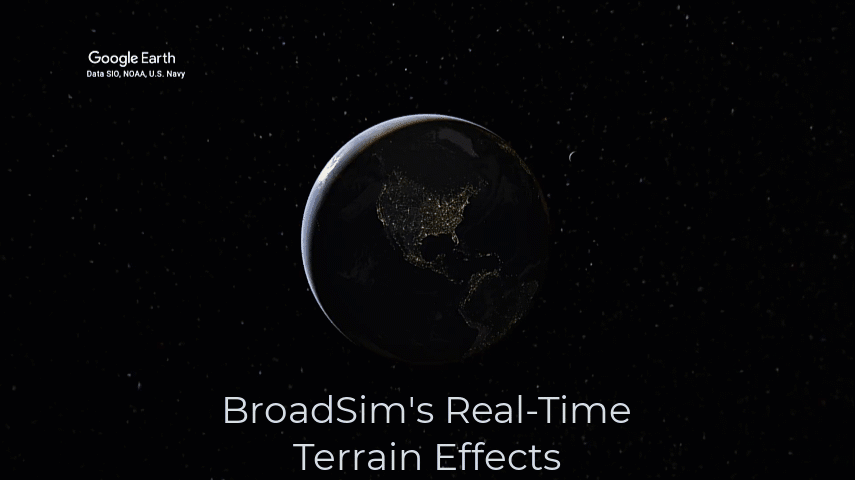
- BroadSim's Real-Time Terrain Effects
BroadSim's Real-Time Terrain Effects DOWNLOAD PDF By Jaemin Powell Intro Establishing realistic terrain effects within a Navigation Warfare (NAVWAR) simulator is becoming a highly sought-after feature when testing Positioning, Navigation, and Timing (PNT) systems for the warfighter. The BroadSim Product Family now provides a real-time Terrain Plug-In solution to create scenarios with terrain attenuated threat signals, i.e., jammers, spoofers, or repeaters. Simply just add the Terrain Plug-In to your threat infested scenario and you will immediately have real-time terrain effects throughout your simulation. At a 50 Hz update rate, the user-interface of the Terrain Plug-In displays: A terrain profile of the vehicle and the threat (selected from the dropdown menu), the position of the threat and UUT on a map, and the attenuation for each signal. Conclusion The Terrain Plug-In allows the user to easily replicate similar situations from real-world events or field tests, such as NAVFEST or PNTAX, without needing to know terms like knife-edge diffraction or smooth earth diffraction. Replicating real-world situations and field tests in the simulation environment saves time, money, and resources by allowing developers and users to test PNT systems at any time of the year. This capability was designed so that manufacturers and end-users can better develop and test cutting edge PNT solutions to protect and enable the warfighter. Don’t let the capabilities of your simulator hold you back from testing your PNT system requirements! For more information on the Terrain Plug-In or any other BroadSim Product Family capabilities, please contact Orolia Defense & Security . DOWNLOAD PDF
- SkyNaute | Safran Federal Systems
Home • Products • Inertial Navigation Systems • SkyNaute ™ SkyNaute™ Ultra compact hybrid inertial reference system SkyNaute ™ PRODUCT | INERTIAL NAVIGATION SYSTEMS Consumption 20 W Weight 6.6 lbs Size 3 L MTBF > 1 million hours ANY QUESTIONS? GET QUOTE About SkyNaute™ hybrid inertial/GNSS navigation system meets all the safety and reliability requirements for airplanes, helicopters and drones. Thanks to the HRG Crystal™, SkyNaute™ is the most competitive aeronautical navigation system on the market. Optimized SWaP Modular and adaptable to fit all civil and military requirements High integrity and accuracy The most competitive aeronautical navigation system on the market SkyNaute™ meets all the safety and reliability requirements for airplanes, helicopters, and drones. High performance inertial and piloting data Protection levels for RNP/RNP-AR operations Fly-by-Wire, SVS (Synthetic Vision System) & HUD (Head-Up Display) architecture ready solution Click to download the SkyNaute ™ data sheet. VIEW DATA SHEET
- Panorama | Safran Federal Systems
Home • Products • GNSS Testing & Simulation • Panorama Panorama Visual Analysis Tool for GNSS Receiver Data Panorama PRODUCT | GNSS TESTING & SIMULATION Data Sources Designed for log files generated by PANACEA and RxStudio View Data Generates plots for receivers, scenarios, and sum ANY QUESTIONS? GET QUOTE About Panorama is the flagship tool when it comes to analyzing receiver data. When engineers use Panorama they spend more time looking at plots and making decisions, instead of making plots and writing reports. Panorama takes receiver data (.csv files) from PANACEA and RxStudio (other ODS products) and turns it into over 60 engineering plots ready to view at the click of your mouse. These plots give engineers and analysts the ability to view summary level data, head to head comparisons, receiver specific results, and 3D LLA replays using STK. PANACEA and Panorama provide a cohesive data collection and reporting capability that enables testers to show the data in real-time providing after action reporting near instantly. Data Sources Panorama is a tool that is used to view and analyze GNSS receiver output data. Panorama was designed specifically to take the log files that PANACEA and RxStudio generate and turn them into engineering plots. Panorama allows users to place receiver data anywhere on their machine. Easily input multiple data sources from various locations on your machine. Panorama will automatically populate using the default file directories. Automatically Generate Reports Panorama supports automatic report generation for scenarios and specific receivers. With 1 click of the mouse, you can generate hundreds of reports that provide detailed descriptions of the scenario and corresponding plots. When you click to automatically generate scenario reports, two reports for each scenario will be generated: Scenario Description Report and Scenario Plot Report. Scenario Description Report Scenario Description Report The scenario description report provides the actual data entries for paramaters such as: Scenario name, notes, duration, truth source, timelines, motion profile, LLA, GPS constellation, constellation (almanac, ephemeris, time, code), jamming, events and more. This report can be used as an example to show others how to create this exact scenario and how to configure and test the UUT’s in the same configuration. Scenario Plot Report The scenario plot report provides the plots (not numbers) within the PDF for the following: # SVs used, # SVs locked, position error, velocity error, pulse error, absolute pulse error, ET position error, 3D LLA, log map, slope of date/time, and fix statistics. These plot reports are excellent for decision making and for analyzing how the receiver performed in different scenarios. PLOT INFO Summary Plots The summary plots tab allows users to view parameters such as average number of SVs used, average position error, time to first fix and many more at a test plan level (where scenario data is aggregated together). While viewing the summary plots tab, users can easily flip views to look at specific receivers, scenarios, test plans or even suites. ✔ Average # of SVs Used ✔ Average # of SVs Locked ✔ Average Position Error ✔ Average Velocity Error ✔ Average Pulse Error ✔ Average Date ✔ Percent Frames Received ✔ Percent under Threshold ✔ Percent of Time Fixed ✔ Percent of Frames Fixed ✔ Time of First Fix ✔ Time of First Loss ✔ Time of Last Fix Scenario Plots The scenario plots tab goes one step deeper to view receivers under test for a specific scenario. Scenario plots provide side by side comparisons for all of the units under test both in performance and vulnerabilities. Data outputs include fix statistics, 3D LLA, frame time error and much more. ✔ Number of SVs Used ✔ Number of SVs Locked ✔ Position Error ✔ Velocity Error ✔ Pulse Error ✔ Absolute Pulse Error ✔ ET Position Error ✔ 3D LLA ✔ Log Map ✔ Map ✔ Fix Statistics ✔ Date ✔ Slope of GPS Time ✔ Slope of UTC Time ✔ Frame Time Error Receiver Plots The receiver plots tab allows for the deepest dive where engineers can analyze one specific receiver for a specific scenario. Plots of DOP, C/No used, SV elevation and various others can be seen under the receiver plots tab. ✔ Number Used/Locked ✔ Position Error ✔ Velocity Error ✔ Position Error Estimate ✔ Pulse Error ✔ Absolute Pulse Error ✔ ET Position Error ✔ DOP ✔ C/No Used ✔ C/No All ✔ Track State Used ✔ Track State All ✔ Code Type Used ✔ Code Type All ✔ Frequency Used ✔ Frequency All ✔ Range Residuals - Line ✔ Range Residuals - Heat ✔ Sky Plot ✔ SV Elevation ✔ SV Azimuth ✔ Date ✔ UTC/GPS Time Comparison Click to download the Panorama data sheet. VIEW DATA SHEET